Lillaz Waterfalls

Edited by:
Massimo Martini
Access
Road directions
Leave the motorway at the Aosta Ovest junction and turn right onto the towards the Cogne Valley. Drive through the village of Aymavilles and, after 1.5 km (1.5 km), take the second exit at the roundabout. Continue along the for 18.7 km (20.2 km), passing through the villages of Vieyes, Epinel and Crétaz, until you reach a roundabout: take the second exit, following the signs for Lillaz. Continue along the local road for 1 km (21.2 km) until you reach another roundabout; carry on straight for a further 1.8 km (23.0 km in total) until you reach the large car park in Lillaz.
Car park
The Lillaz car park 🅿️ consists of three sections: the spaces closest to the trailheads are pay-and-display, the central ones are free, and those furthest away are reserved for campervans.
Access by public transport
The service is provided by SVAP, with a seasonal Cogne–Lillaz route. Outside the summer season, you’ll need a private vehicle to reach Lillaz from the Cogne stop. For up-to-date timetables, please consult the SVAP Routes and Timetables page.
Access on foot
from Lillaz, via the (12)G | Lillaz Waterfalls, circular route from the Lillaz car park
from Lillaz, via trail | Lake Loie, from Lillaz via the Vallon de l'Urtier
Distance and journey time
🕒 Journey time: [to be completed]
📏 Distance: 23.0 km
GPS navigation
Important information
The directions provided were verified on the date the route was mapped. Before setting off, we recommend checking for any changes to the route or road conditions. For up-to-date information, please consult Google Maps or Apple Maps.
Introduction
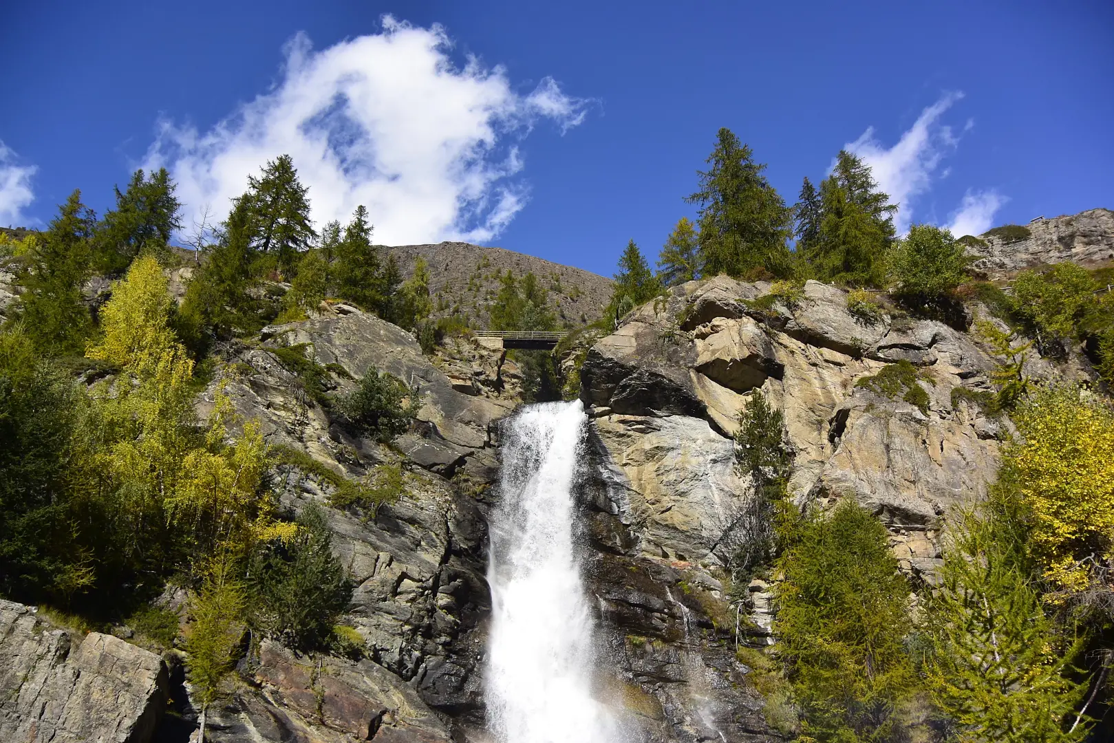
The Lillaz Waterfalls are situated in the hamlet of the same name within the municipality of Cogne, in the Aosta Valley, within the Gran Paradiso National Park. The Urtier stream, fed by the glaciers of the valley of the same name, forms three main drops here, which follow one another along a short stretch of the watercourse, reaching a total height of around 150 metres. The site can be reached via a footpath that starts directly from the village of Lillaz, equipped with steps and footbridges at the steepest points. A geological nature trail, with information panels along the first section, provides an insight into the valley’s glaciological context.
Description
The Urtier stream flows down from the valley of the same name and, just upstream of the village of Lillaz, encounters a rocky stretch that gives rise to its three main waterfalls. The first, which is the most accessible, ends in a natural pool that can be reached in a few minutes from the village centre; the second can be viewed from a wooden bridge spanning the stream; the third, beyond the bridge, is reached via a grassy ledge which marks the highest point of the walking route. The sources consulted do not agree on the exact altitude of this point: [to be completed — disputed figure, see editorial note].
The path linking the three waterfalls runs almost entirely along a well-maintained surface, with sections featuring steps carved into the rock and wooden walkways fitted with railings, and passes through a mixed forest of larch and spruce. Information panels dedicated to the glacial geology of the valley are installed along the route. The wildlife of the Gran Paradiso National Park is commonly found in the surrounding area, in particular marmots and ibex.
The waterfalls change in appearance throughout thethroughout the year: the flow is at its highest in spring, due to snowmelt, whilst in winter the waterfalls are subject to ice formations that attract ice climbers.
Information
General information
Municipality: Cogne
hamlet: Lillaz
stream: Urtier
total elevation gain: approx. 150m (three main drops)
elevation at the highest point of the route: disputed figure — sources indicate values between 1,617 m and 1,745 m, see editorial note
protected area: Gran Paradiso National Park
Region: Aosta Valley
Region:Aosta Valley
Country: Italy